Developed and maintained by the Tennessee State Library & Archives, this interactive map overlays historical maps onto present-day maps of Nashville, Memphis, Knoxville, and Chattanooga, revealing how Black neighborhoods looked prior to their erasure from the landscape by mid-century Urban Renewal projects.
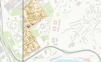
The Knoxville, Tennessee, map is zoomed to the neighborhood demolished for the construction of James White Parkway, as represented by a 1917 Sanborn Fire Insurance Map. Yellow structures documented therein are built of wood, while those in pink are made of brick. The "D" appearing on most of the wooden buildings indicates a single family dwelling.